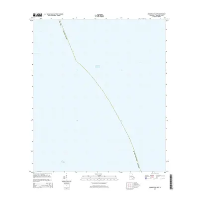
2015 Map of Chandeleur Light
USGS Topo · Published 2015About this map
The Gulf of Mexico dominates this coastal survey, where the open waters of the Sound meet the marshy boundaries of St. Bernard Parish. As an modern topographic record, the map illustrates the maritime character of this outer boundary of Louisiana, centered on the submerged and shifting lands of the Chandeleur Islands chain. Though terrestrial features are sparse, the sheet defines the administrative reach of the state into these vital fishing and migratory waters. This map is particularly relevant for those tracking the environmental change and shoreline evolution of the Mississippi River Delta region.
Find a feature on this map
3 named features on this map. Tap any name to fly to it.
Don’t see what you’re looking for? This feature index may not catch every label — zoom into the map to look around manually.
Map Details
Editions of this 2015 Chandeleur Light Map
This is the sole edition of this map. No revisions or reprints were ever made.
Other maps of this area

1941 · Horn Island
USGS Topo · 1:62,500

1942 · Horn Island
USGS Topo · 1:62,500

1950 · Dog Keys Pass
USGS Topo · 1:24,000

1950 · Ship Island
USGS Topo · 1:24,000

1951 · North Islands
USGS Topo · 1:24,000

1951 · Chandeleur Light
USGS Topo · 1:24,000

1953 · Mobile
USGS Topo · 1:250,000

1957 · Mobile
USGS Topo · 1:250,000

1957 · Breton Sound
USGS Topo · 1:250,000

1960 · Mobile
USGS Topo · 1:250,000