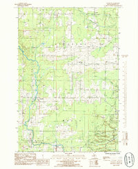
1985 Map of Chandler
USGS Topo · Published 1985About this map
The Escanaba River and Ford River define the natural geography of this Delta County region, where industrial infrastructure meets the Escanaba River State Forest. In the mid-1980s, the landscape was shaped by a mix of extraction and transit, evidenced by a Limestone Quarry and a sprawling Gravel Pit positioned near significant rail corridors. The Soo Line and Chicago and North Western railroads represent the area's legacy as a transportation hub for timber and mineral resources. Local community life is anchored by landmarks like the Holy Family Ch in Flat Rock and the Moser Community Center, while smaller settlements such as Bichler, Riverland, and Chandler illustrate the rural residential patterns of the Upper Peninsula. Surveyed as a provisional map, this record documents the precise placement of a regional Pipeline and Substation amidst the forests and wetlands.
Find a feature on this map
23 named features on this map. Tap any name to fly to it.
Don’t see what you’re looking for? This feature index may not catch every label — zoom into the map to look around manually.
Map Details
Editions of this 1985 Chandler Map
This is the sole edition of this map. No revisions or reprints were ever made.
Other maps of this area

1932 · Gladstone NE
USGS Topo · 1:31,680

1932 · Gladstone SE
USGS Topo · 1:31,680

1932 · Bark River NE
USGS Topo · 1:31,680

1932 · Whitney NE
USGS Topo · 1:31,680

1932 · Whitney SE
USGS Topo · 1:31,680

1932 · Gladstone SW
USGS Topo · 1:31,680

1932 · Gladstone NW
USGS Topo · 1:31,680

1950 · Gladstone NW
USGS Topo · 1:31,680

1954 · Escanaba
USGS Topo · 1:250,000

1957 · Escanaba
USGS Topo · 1:250,000