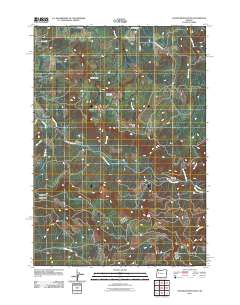
2011 Map of Chandler Mountain
USGS Topo · Published 2011About this map
The Calapooia River carves a central path through this section of Linn County, shaping a landscape defined by significant drainage systems and prominent peaks. The small settlement of Calapooia is situated near the western edge, while the upland area is anchored by Chandler Mountain and the distinctive landmark of Chimney Rock. This 2011 survey documents the established timber and forest service road network, including Upper Calapooia Dr and NFD 2820 Rd, which navigate the steep elevations between the river valley and high points like Cassnor Park.
Find a feature on this map
23 named features on this map. Tap any name to fly to it.
Don’t see what you’re looking for? This feature index may not catch every label — zoom into the map to look around manually.
Map Details
Editions of this 2011 Chandler Mountain Map
This is the sole edition of this map. No revisions or reprints were ever made.
Other maps of this area

1921 · Brownsville
USGS Topo · 1:62,500

1950 · Marcola
USGS Topo · 1:62,500

1950 · Brownsville
USGS Topo · 1:62,500

1951 · Sweet Home
USGS Topo · 1:62,500

1951 · Leaburg
USGS Topo · 1:62,500

1952 · Brownsville
USGS Topo · 1:62,500

1952 · Marcola
USGS Topo · 1:62,500

1953 · Salem
USGS Topo · 1:250,000

1954 · Salem
USGS Topo · 1:250,000

1960 · Salem
USGS Topo · 1:250,000