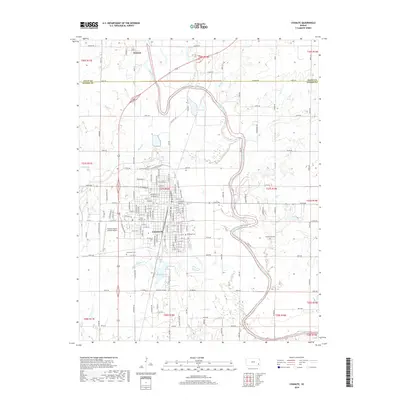
2018 Map of Chanute
USGS Topo · Published 2018About this map
The Neosho River meanders through this landscape, defining the geography of the Neosho and Allen County border just north of Chanute. The city itself is the primary hub, showing a developed grid of residential streets such as W Main St and E Main St that radiate from the central core. Local history and genealogy interests are well-represented by several burial grounds, including Saint Patricks Cem, Elmwood Cem, and Greenlawn Cem, while the outlying Greenwood Cem sits east of the river bends.
Find a feature on this map
86 named features on this map. Tap any name to fly to it.
Don’t see what you’re looking for? This feature index may not catch every label — zoom into the map to look around manually.
Map Details
Editions of this 2018 Chanute Map
This is the sole edition of this map. No revisions or reprints were ever made.
Other maps of this area

1886 · Fredonia
USGS Topo · 1:125,000

1886 · Iola
USGS Topo · 1:125,000

1893 · Iola
USGS Topo · 1:125,000

1894 · Fredonia
USGS Topo · 1:125,000

1904 · Iola
USGS Topo · 1:125,000

1938 · Altoona
USGS Topo · 1:62,500

1939 · Altoona
USGS Topo · 1:48,000

1943 · Altoona
USGS Topo · 1:62,500

1947 · Joplin
USGS Topo · 1:250,000

1949 · Joplin
USGS Topo · 1:250,000