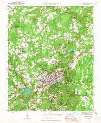
1946 Map of Chapel Hill
USGS Topo · Published 1968About this map
Chapel Hill and Carrboro form a dense residential and academic hub at the center of this mid-century survey, surrounded by a rural landscape of ridges and creek valleys. The layout of the university town is clearly visible, featuring established residential areas like Tenney Circle and Davie Circle, while the Horace Williams Airport sits just north of the urban core. The Southern railroad line terminates in Carrboro, marking its history as a mill and transit point. Outside the town limits, the terrain is defined by prominent elevations such as Bald Mtn and Blackwood Mtn, with University Lake serving as a significant western water feature. This area was a mosaic of small farming communities and educational outposts, evidenced by the numerous country churches like Union Grove Ch and Orange Ch, and rural schoolhouses including Morris Grove Sch and Piney Mountain Sch.
Find a feature on this map
49 named features on this map. Tap any name to fly to it.
Don’t see what you’re looking for? This feature index may not catch every label — zoom into the map to look around manually.
Map Details
Editions of this 1946 Chapel Hill Map
2 editions found
Other maps of this area

1943 · Durham South
USGS Topo · 1:62,500

1946 · Chapel Hill
USGS Topo · 1:24,000

1947 · Chapel Hill
USGS Topo · 1:31,680

1951 · Farrington
USGS Topo · 1:24,000

1951 · Durham South
USGS Topo · 1:62,500

1951 · Durham North
USGS Topo · 1:62,500

1953 · Raleigh
USGS Topo · 1:250,000

1953 · Greensboro
USGS Topo · 1:250,000

1954 · Greensboro
USGS Topo · 1:250,000

1954 · Raleigh
USGS Topo · 1:250,000