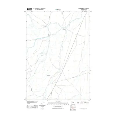
2012 Map of Chapman Bench
USGS Topo · Published 2012About this map
Clarks Fork Yellowstone River winds through this High Plains landscape, where water management is the defining feature of local land use. The map illustrates a complex network of irrigation infrastructure necessary for ranching, including the State Ditch and Lake Creek Ditch. These systems support long-established operations like the Lewellen Ranch and Hoff Ranch. The topography is dominated by expansive elevated plateaus, most notably Chapman Bench and Kimball Bench, which rise above the drainages of Pat O'Hara Cr and Paint Cr. The road network consists largely of rural routes such as Little Sand Coulee Rd and the descriptively named Black and White Rd, connecting the scattered ranching homesteads across the arid benchlands of Park County.
Find a feature on this map
18 named features on this map. Tap any name to fly to it.
Don’t see what you’re looking for? This feature index may not catch every label — zoom into the map to look around manually.
Map Details
Editions of this 2012 Chapman Bench Map
This is the sole edition of this map. No revisions or reprints were ever made.
Other maps of this area
1949 · Pat O'Hara Mountain
USGS Topo · 1:62,500
1949 · Cody
USGS Topo · 1:62,500
1950 · Clark
USGS Topo · 1:62,500
1950 · Deep Lake
USGS Topo · 1:62,500
1951 · Cody
USGS Topo · 1:62,500

1955 · Cody
USGS Topo · 1:250,000

1958 · Cody
USGS Topo · 1:250,000

1962 · Cody
USGS Topo · 1:250,000
1980 · Cody
USGS Topo · 1:100,000
1987 · Badger Basin
USGS Topo · 1:24,000