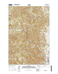
2017 Map of Chapman
USGS Topo · Published 2017About this map
Scappoose serves as the southern anchor for this map of Columbia County, where the valley floor gives way to the rising timberlands of the Coast Range. The landscape is defined by its industrial history, particularly the presence of the Crown Zellerbach Trail which follows the path of former logging corridors through Spitzenberg and Chapman. These small settlements and rural crossroads are connected by a network of family-named roads like Wilark Rd and Pittsburg Rd, reflecting the generational roots of the local community.
Find a feature on this map
104 named features on this map. Tap any name to fly to it.
Don’t see what you’re looking for? This feature index may not catch every label — zoom into the map to look around manually.
Map Details
Editions of this 2017 Chapman Map
This is the sole edition of this map. No revisions or reprints were ever made.
Other maps of this area
1915 · Hillsboro
USGS Topo · 1:62,500
1918 · Hillsboro
USGS Topo · 1:62,500
1922 · St. Helens
USGS Topo · 1:62,500
1940 · Hillsboro
USGS Topo · 1:62,500
1940 · Vernonia
USGS Topo · 1:62,500
1941 · St Helens
USGS Topo · 1:62,500
1941 · Gales Creek
USGS Topo · 1:62,500
1943 · Vernonia
USGS Topo · 1:62,500
1943 · St Helens
USGS Topo · 1:62,500

1948 · Vancouver
USGS Topo · 1:250,000