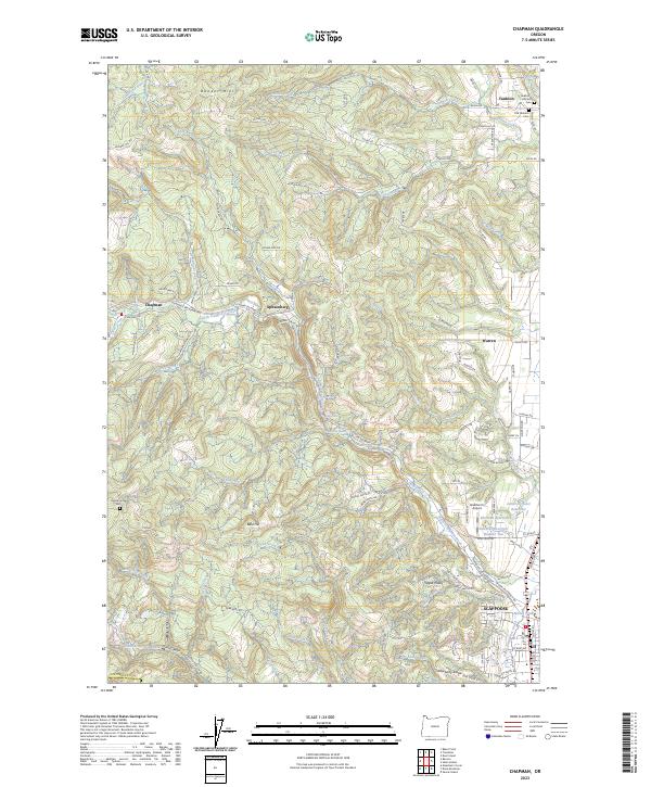
2023 Map of Chapman
USGS Topo · Published 2023About this map
The hills of Columbia County, Oregon, define a landscape of deeply incised creeks and scattered upland settlements in this 2023 record. The terrain is dominated by features like Bunker Hill and Bald Hill, while the drainage network of Clatskanie River, North Scappoose Creek, and Milton Creek shapes the local geography. Development is concentrated along the Scappoose Vernonia Hwy and the eastern edge near Scappoose and Warren. Family and local history is preserved through sites such as the Old Yankton Cem and Yankton Hillcrest Cem near Yankton, as well as the Pisgah Home Cem further west. Smaller communities like Spitzenberg, Chapman, and Apple Valley occupy the valleys and ridges between the extensive forest tracts, while aviation history is represented by Grabhorn's Airport. This modern survey details the persistent rural character of the region, showing how contemporary infrastructure like the Crown-Zellerbach Rd overlays historic settlement patterns.
Find a feature on this map
117 named features on this map. Tap any name to fly to it.
Don’t see what you’re looking for? This feature index may not catch every label — zoom into the map to look around manually.
Map Details
Editions of this 2023 Chapman Map
This is the sole edition of this map. No revisions or reprints were ever made.
Other maps of this area

1915 · Hillsboro
USGS Topo · 1:62,500

1918 · Hillsboro
USGS Topo · 1:62,500

1922 · St. Helens
USGS Topo · 1:62,500

1940 · Hillsboro
USGS Topo · 1:62,500

1940 · Vernonia
USGS Topo · 1:62,500

1941 · St Helens
USGS Topo · 1:62,500

1941 · Gales Creek
USGS Topo · 1:62,500

1943 · Vernonia
USGS Topo · 1:62,500

1943 · St Helens
USGS Topo · 1:62,500

1948 · Vancouver
USGS Topo · 1:250,000