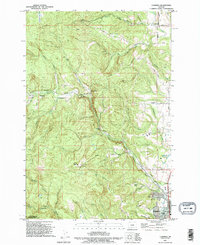
1990 Map of Chapman
USGS Topo · Published 1995About this map
Scappoose sits at the foot of the rising Coast Range, where the landscape transitions from the flat valley floor to the steep, timbered ridges of Bunker Hill and Strawberry Ridge. In the early 1990s, the area retained a mix of residential growth and active resource extraction, with numerous quarries and gravel pits dotting the hillsides near Yankton and Spitzenberg. The drainage of North Scappoose Creek and its many tributaries, including Heimuller Creek and Cedar Creek, creates a complex topography of deep canyons and high points like Bald Hill.
Find a feature on this map
56 named features on this map. Tap any name to fly to it.
Don’t see what you’re looking for? This feature index may not catch every label — zoom into the map to look around manually.
Map Details
Editions of this 1990 Chapman Map
This is the sole edition of this map. No revisions or reprints were ever made.
Other maps of this area

1915 · Hillsboro
USGS Topo · 1:62,500

1918 · Hillsboro
USGS Topo · 1:62,500

1922 · St. Helens
USGS Topo · 1:62,500

1940 · Hillsboro
USGS Topo · 1:62,500

1940 · Vernonia
USGS Topo · 1:62,500

1941 · St Helens
USGS Topo · 1:62,500

1941 · Gales Creek
USGS Topo · 1:62,500

1943 · Vernonia
USGS Topo · 1:62,500

1943 · St Helens
USGS Topo · 1:62,500

1948 · Vancouver
USGS Topo · 1:250,000