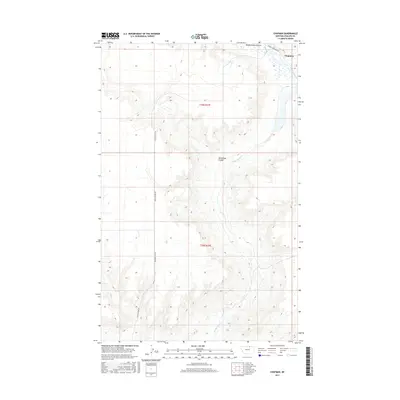
2017 Map of Chapman
USGS Topo · Published 2017About this map
Chapman sits in the northeast corner of this Phillips County landscape, a region defined by the intricate drainages of the northern plains. The terrain is dominated by the meandering course of Woody Island Cr and the wider Woody Island Coulee, which cut through the higher benches of t36n r27e and t35n r27e. These natural depressions serve as the primary geographical markers in a landscape otherwise organized by the rectangular grid of the Public Land Survey System.
Find a feature on this map
8 named features on this map. Tap any name to fly to it.
Don’t see what you’re looking for? This feature index may not catch every label — zoom into the map to look around manually.
Map Details
Editions of this 2017 Chapman Map
This is the sole edition of this map. No revisions or reprints were ever made.
Other maps of this area
1920 · Avery
USGS Topo · 1:125,000

1953 · Havre
USGS Topo · 1:250,000

1957 · Havre
USGS Topo · 1:250,000

1958 · Havre
USGS Topo · 1:250,000
1984 · Chapman
USGS Topo · 1:24,000
1984 · Emerick Bench
USGS Topo · 1:24,000
1984 · Chapman NW
USGS Topo · 1:24,000
1984 · Turner NE
USGS Topo · 1:24,000
1984 · Down Reservoir NE
USGS Topo · 1:24,000
1984 · Horseshoe Lake
USGS Topo · 1:24,000