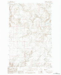
1984 Map of Horseshoe Lake
USGS Topo · Published 1984About this map
Horseshoe Lake anchors the high plains of northern Phillips County in this mid-1980s provisional study. The landscape is defined by the subtle drainage patterns of Alkali Coulee and Lambing Coulee, which snake through the prairie terrain. This era of land use in rural Montana is marked by minimal structural development, though the presence of Storage Bins at various points across the quadrangle indicates the ongoing agricultural activity in the region. The topography is meticulously captured through ten-foot contour intervals, revealing the gentle rises and depressions characteristic of this part of the state before the digital mapping era.
Find a feature on this map
4 named features on this map. Tap any name to fly to it.
Don’t see what you’re looking for? This feature index may not catch every label — zoom into the map to look around manually.
Map Details
Editions of this 1984 Horseshoe Lake Map
This is the sole edition of this map. No revisions or reprints were ever made.
Other maps of this area

1920 · Avery
USGS Topo · 1:125,000

1920 · Cowan
USGS Topo · 1:125,000

1953 · Havre
USGS Topo · 1:250,000

1954 · Glasgow
USGS Topo · 1:250,000

1957 · Glasgow
USGS Topo · 1:250,000

1957 · Havre
USGS Topo · 1:250,000

1958 · Glasgow
USGS Topo · 1:250,000

1958 · Havre
USGS Topo · 1:250,000

1984 · Chapman
USGS Topo · 1:24,000

1984 · Emerick Bench
USGS Topo · 1:24,000