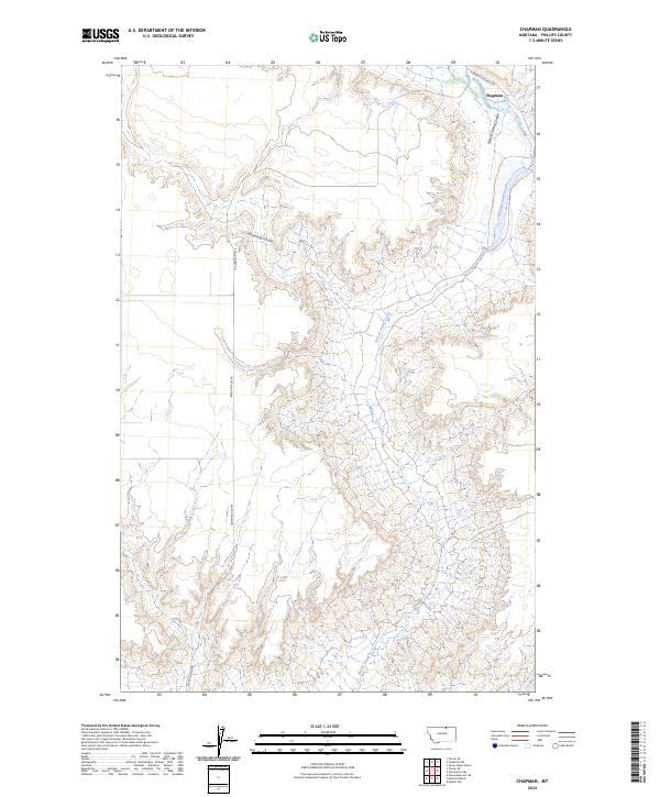
2024 Map of Chapman
USGS Topo · Published 2024About this map
Chapman sits at the northern edge of this high-plains landscape, where the intermittent drainage of Woody Island Coulee meets Woody Island Creek. The terrain is defined by the deep, winding incisions of coulees into the surrounding prairie, a characteristic formation of north-central Montana. Notable among these is the sweeping curve of Horseshoe Coulee, which carves through the central portion of the quadrangle. Transportation in this sparsely populated region relies on long, straight routes such as Black Coulee Rd and the Turner Cutacross Rd, reflecting the large-scale grid of the Public Land Survey System that organizes the ranching and agricultural lands of Phillips County.
Find a feature on this map
9 named features on this map. Tap any name to fly to it.
Don’t see what you’re looking for? This feature index may not catch every label — zoom into the map to look around manually.
Map Details
Editions of this 2024 Chapman Map
This is the sole edition of this map. No revisions or reprints were ever made.
Other maps of this area

1920 · Avery
USGS Topo · 1:125,000

1953 · Havre
USGS Topo · 1:250,000

1957 · Havre
USGS Topo · 1:250,000

1958 · Havre
USGS Topo · 1:250,000

1984 · Chapman
USGS Topo · 1:24,000

1984 · Emerick Bench
USGS Topo · 1:24,000
1984 · Chapman NW
USGS Topo · 1:24,000

1984 · Turner NE
USGS Topo · 1:24,000
1984 · Down Reservoir NE
USGS Topo · 1:24,000
1984 · Horseshoe Lake
USGS Topo · 1:24,000