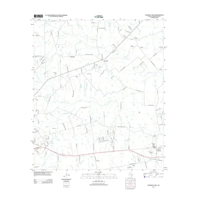
2013 Map of Chappell Hill
USGS Topo · Published 2013About this map
The Main Street Historic District serves as a centerpiece for this part of Washington County, anchoring the settlement of Chappell Hill. The surrounding landscape is defined by its agrarian roots and family history, evidenced by a high density of rural burial grounds such as Coplyn Spring Cem, Masonic Cem, and Saint Stanislaus Cem. This 2013 survey illustrates the local infrastructure, from the Brenham Municipal Airport on the western edge to the network of creeks like Kuykendall Cr and Peach Cr that drain the territory.
Find a feature on this map
133 named features on this map. Tap any name to fly to it.
Don’t see what you’re looking for? This feature index may not catch every label — zoom into the map to look around manually.
Map Details
Editions of this 2013 Chappell Hill Map
This is the sole edition of this map. No revisions or reprints were ever made.
Other maps of this area

1914 · Gay Hill
USGS Topo · 1:62,500

1914 · Navasota
USGS Topo · 1:62,500

1930 · Brenham
USGS Topo · 1:62,500

1954 · Austin
USGS Topo · 1:250,000

1956 · Hempstead
USGS Topo · 1:62,500

1956 · Brenham
USGS Topo · 1:62,500

1958 · Washington
USGS Topo · 1:24,000

1959 · Gay Hill
USGS Topo · 1:24,000

1959 · Independence
USGS Topo · 1:24,000
1961 · Daniels
USGS Topo · 1:24,000