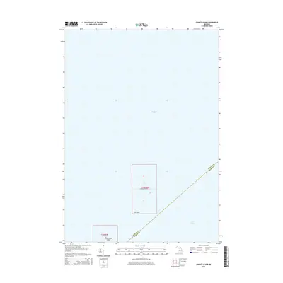
2014 Map of Charity Island
USGS Topo · Published 2014About this map
Charity Island and its smaller neighbors anchor this maritime survey where the waters of Saginaw Bay meet the broader expanse of Lake Huron. The map focuses on a secluded archipelago that marks a significant transition point for Great Lakes navigation. To the southwest of the main island lies Little Charity Island, while the small outcrop of Gull Island sits just off the southern tip of the primary landmass. This 2014 edition captures the precise topography of these isolated features, illustrating their relief and the bathymetry of the surrounding shallows. The boundary between Arenac and Huron counties cuts diagonally across the open water, emphasizing the islands' position as a shared geographical landmark in the bay.
Find a feature on this map
11 named features on this map. Tap any name to fly to it.
Don’t see what you’re looking for? This feature index may not catch every label — zoom into the map to look around manually.
Map Details
Editions of this 2014 Charity Island Map
This is the sole edition of this map. No revisions or reprints were ever made.
Other maps of this area

1954 · Flint
USGS Topo · 1:250,000

1954 · Tawas City
USGS Topo · 1:250,000

1958 · Flint
USGS Topo · 1:250,000

1958 · Tawas City
USGS Topo · 1:250,000

1966 · Point Lookout
USGS Topo · 1:24,000

1966 · Alabaster
USGS Topo · 1:24,000

1970 · Caseville
USGS Topo · 1:24,000

1970 · Sand Point
USGS Topo · 1:24,000
1970 · Charity Island
USGS Topo · 1:24,000

1984 · Tawas City
USGS Topo · 1:100,000