
1970 Map of Sand Point
USGS Topo · Published 1973About this map
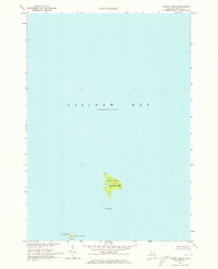
Saginaw Bay dominates this coastal survey, where the finger-like projection of Sand Point reaches out from the shoreline of Caseville Twp. The map illustrates a landscape defined by the water, showing the intricate bathymetry of the bay and the sheltered waters of Wildfowl Bay to the south. Along the northern coast of the point, the residential development of Crescent Beach is visible, served by Crescent Beach Rd.
Find a feature on this map
8 named features on this map. Tap any name to fly to it.
Don’t see what you’re looking for? This feature index may not catch every label — zoom into the map to look around manually.
Map Details
Editions of this 1970 Sand Point Map
This is the sole edition of this map. No revisions or reprints were ever made.
Other maps of this area

1954 · Flint
USGS Topo · 1:250,000

1954 · Tawas City
USGS Topo · 1:250,000

1958 · Flint
USGS Topo · 1:250,000

1958 · Tawas City
USGS Topo · 1:250,000

1966 · Point Lookout
USGS Topo · 1:24,000

1970 · Bay Port West
USGS Topo · 1:24,000

1970 · Bay Port East
USGS Topo · 1:24,000

1970 · Caseville
USGS Topo · 1:24,000
1970 · Charity Island
USGS Topo · 1:24,000

1984 · Tawas City
USGS Topo · 1:100,000