
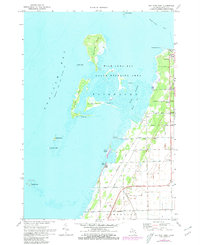
1970 Map of Bay Port West
USGS Topo · Published 1972About this map
Saginaw Bay and the marshy archipelago of Wildfowl Bay dominate this coastal survey of Michigan’s Thumb region. The landscape is defined by the transition from open water to the dense wetlands of the Fairhaven State Wildlife Area, where complex channels like Rush Cut, Dynamite Cut, and Blind Pass navigate between Heisterman Island and the Middle Grounds. These intricate waterways reflect a coastline managed for both ecological preservation and recreational access, as evidenced by several boat ramps and the nearby Roadside Park.
Find a feature on this map
39 named features on this map. Tap any name to fly to it.
Don’t see what you’re looking for? This feature index may not catch every label — zoom into the map to look around manually.
Map Details
Editions of this 1970 Bay Port West Map
2 editions found
Other maps of this area

1954 · Flint
USGS Topo · 1:250,000

1958 · Flint
USGS Topo · 1:250,000

1963 · Fish Point
USGS Topo · 1:24,000

1963 · Owendale
USGS Topo · 1:24,000

1963 · Sebewaing
USGS Topo · 1:24,000

1970 · Bay Port East
USGS Topo · 1:24,000

1970 · Caseville
USGS Topo · 1:24,000

1970 · Sand Point
USGS Topo · 1:24,000
1984 · Bay City
USGS Topo · 1:100,000
2011 · Fish Point
USGS Topo · 1:24,000