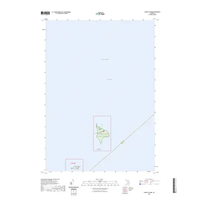
2023 Map of Charity Island
USGS Topo · Published 2023About this map
Charity Island and its smaller neighbors sit isolated within the waters of Saginaw Bay in this modern survey of the region. This remote island group is largely defined by the Michigan Islands National Wildlife Refuge, which encompasses the terrestrial features to protect local avian habitats. The map clearly delineates the administrative and geographical split in the open water between Arenac and Huron Counties, marking the boundaries that intersect the bay. To the south, Little Charity Island and the small Gull Island complete the archipelago. The surrounding expanse of Lake Huron dominates the sheet, illustrating the maritime environment that separates these protected lands from the Michigan mainland.
Find a feature on this map
11 named features on this map. Tap any name to fly to it.
Don’t see what you’re looking for? This feature index may not catch every label — zoom into the map to look around manually.
Map Details
Editions of this 2023 Charity Island Map
This is the sole edition of this map. No revisions or reprints were ever made.
Other maps of this area

1954 · Flint
USGS Topo · 1:250,000

1954 · Tawas City
USGS Topo · 1:250,000

1958 · Flint
USGS Topo · 1:250,000

1958 · Tawas City
USGS Topo · 1:250,000

1966 · Point Lookout
USGS Topo · 1:24,000

1966 · Alabaster
USGS Topo · 1:24,000

1970 · Caseville
USGS Topo · 1:24,000

1970 · Sand Point
USGS Topo · 1:24,000
1970 · Charity Island
USGS Topo · 1:24,000

1984 · Tawas City
USGS Topo · 1:100,000