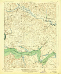
1918 Map of Charles City
USGS Topo · Published 1931About this map
The James River and Chickahominy River define the tidewater geography of this early twentieth-century survey, where the river-based economy of historic Virginia plantations meets a developing inland rail network. Along the northern border, the Chesapeake and Ohio railroad connects settlements like Roxbury and Providence Forge, while the southern riverbanks remain anchored by storied landings such as Berkeley (Harrisons Landing) and Westover. The landscape is densely populated with community markers that provide deep genealogical value, including the Samaria Indian School, Parish Hill Church, and the National Cemetery near Glendale. Numerous small mills and wharves, such as Edna's Mill and Stanley Wharf, indicate a reliance on local water power and maritime transport that persisted decades after the Civil War. The map captures an era where traditional estate names like Upper Brandon and Weyanoke still functioned as central landmarks in a rural, marsh-heavy terrain characterized by Whiteoak Swamp and Toe Ink Swamp.
Find a feature on this map
103 named features on this map. Tap any name to fly to it.
Don’t see what you’re looking for? This feature index may not catch every label — zoom into the map to look around manually.
Map Details
Editions of this 1918 Charles City Map
4 editions found
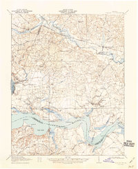
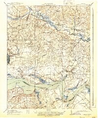
Other maps of this area

1894 · Bermuda Hundred
USGS Topo · 1:62,500

1894 · Petersburg
USGS Topo · 1:62,500

1894 · Richmond
USGS Topo · 1:62,500

1895 · Richmond
USGS Topo · 1:62,500

1917 · Toano
USGS Topo · 1:62,500

1918 · Charles City
USGS Topo · 1:62,500

1918 · Toano
USGS Topo · 1:62,500

1919 · Surry
USGS Topo · 1:62,500

1919 · Disputanta
USGS Topo · 1:62,500

1919 · New Kent
USGS Topo · 1:62,500