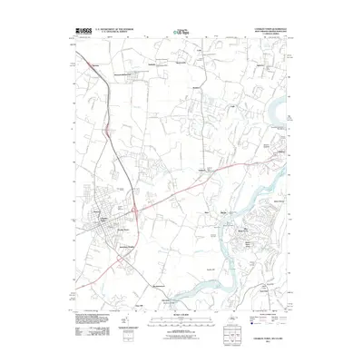
2011 Map of Charles Town
USGS Topo · Published 2011About this map
Charles Town and its historic surroundings appear at a crossroads of rail and river commerce on this detailed survey. The landscape is anchored by the Charles Town Racetrack and the neighboring residential developments of Ranson and Brooke Haven. To the north, the junction of CSX Transportation and Norfolk Southern tracks at Shenandoah Junction marks a critical point in the regional transport network, while small settlements like Bardane, Duffields, and Bakerton dot the agricultural and industrial corridor.
Find a feature on this map
166 named features on this map. Tap any name to fly to it.
Don’t see what you’re looking for? This feature index may not catch every label — zoom into the map to look around manually.
Map Details
Editions of this 2011 Charles Town Map
This is the sole edition of this map. No revisions or reprints were ever made.
Other maps of this area

1884 · Harpers Ferry
USGS Topo · 1:125,000

1891 · Harpers Ferry
USGS Topo · 1:125,000

1893 · Harpers Ferry
USGS Topo · 1:125,000

1908 · Middletown
USGS Topo · 1:48,000

1910 · Antietam
USGS Topo · 1:62,500

1914 · Martinsburg
USGS Topo · 1:48,000

1916 · Martinsburg
USGS Topo · 1:62,500

1916 · Berryville
USGS Topo · 1:62,500

1939 · Berryville
USGS Topo · 1:48,000
1944 · Round Hill
USGS Topo · 1:31,680