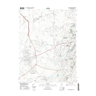
2016 Map of Charles Town
USGS Topo · Published 2016About this map
The Shenandoah and Potomac River converge at the historic nexus of Harpers Ferry, where West Virginia, Virginia, and Maryland meet. This 2016 survey captures the modern geography of this storied landscape, including the sprawling grounds of Harpers Ferry National Historical Park and the Chesapeake and Ohio Canal National Historical Park. The urban corridor of Charles Town and Ranson shows dense development alongside the American Public Univ System, while the surrounding terrain is dotted with ancestral landmarks like Edge Hill Cem and Zion Cem. The map traces the winding Appalachian National Scenic Trail as it crosses the ridges near Keys Gap, providing a detailed view of how contemporary infrastructure, such as the William L Wilson Fwy, integrates with local features like Flowing Springs Run and the industrial activity at Millville.
Find a feature on this map
61 named features on this map. Tap any name to fly to it.
Don’t see what you’re looking for? This feature index may not catch every label — zoom into the map to look around manually.
Map Details
Editions of this 2016 Charles Town Map
This is the sole edition of this map. No revisions or reprints were ever made.
Other maps of this area

1884 · Harpers Ferry
USGS Topo · 1:125,000

1891 · Harpers Ferry
USGS Topo · 1:125,000

1893 · Harpers Ferry
USGS Topo · 1:125,000

1908 · Middletown
USGS Topo · 1:48,000

1910 · Antietam
USGS Topo · 1:62,500

1914 · Martinsburg
USGS Topo · 1:48,000

1916 · Martinsburg
USGS Topo · 1:62,500

1916 · Berryville
USGS Topo · 1:62,500

1939 · Berryville
USGS Topo · 1:48,000
1944 · Round Hill
USGS Topo · 1:31,680