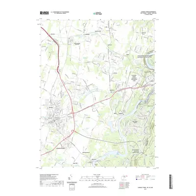
2019 Map of Charles Town
USGS Topo · Published 2019About this map
Charles Town and its surrounding Jefferson County landscape are defined by a complex intersection of historic transport corridors and water resources. The convergence of the Shenandoah River and Potomac River at the edge of Harpers Ferry highlights the strategic geography of the region, further emphasized by the presence of the Chesapeake and Ohio Canal and the Appalachian National Scenic Trail. Settlement patterns are densest around Ranson and the county seat, where the Jefferson County Courthouse and Jefferson County Judicial Center stand as central landmarks.
Find a feature on this map
93 named features on this map. Tap any name to fly to it.
Don’t see what you’re looking for? This feature index may not catch every label — zoom into the map to look around manually.
Map Details
Editions of this 2019 Charles Town Map
This is the sole edition of this map. No revisions or reprints were ever made.
Other maps of this area

1884 · Harpers Ferry
USGS Topo · 1:125,000

1891 · Harpers Ferry
USGS Topo · 1:125,000

1893 · Harpers Ferry
USGS Topo · 1:125,000

1908 · Middletown
USGS Topo · 1:48,000

1910 · Antietam
USGS Topo · 1:62,500

1914 · Martinsburg
USGS Topo · 1:48,000

1916 · Martinsburg
USGS Topo · 1:62,500

1916 · Berryville
USGS Topo · 1:62,500

1939 · Berryville
USGS Topo · 1:48,000
1944 · Round Hill
USGS Topo · 1:31,680