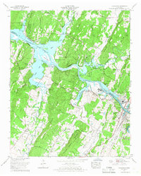
1965 Map of Charleston
USGS Topo · Published 1966About this map
Industrial development and traditional river life meet at the confluence of the Hiwassee River and Chickamauga Lake in the mid-1960s. The neighboring towns of Charleston and Calhoun are clearly defined along the Southern railroad line, separated by the river. To the north and west, the landscape is dominated by the ridges and hollows of the Chickamauga Reservation, where the shoreline is dotted with recreational sites like Camp Cherokee and the B and B Marina.
Find a feature on this map
79 named features on this map. Tap any name to fly to it.
Don’t see what you’re looking for? This feature index may not catch every label — zoom into the map to look around manually.
Map Details
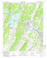
Editions of this 1965 Charleston Map
2 editions found
Other maps of this area

1886 · Cleveland
USGS Topo · 1:125,000

1892 · Cleveland
USGS Topo · 1:125,000

1895 · Cleveland
USGS Topo · 1:125,000

1901 · Cleveland
USGS Topo · 1:125,000

1935 · East Cleveland
USGS Topo · 1:24,000

1935 · Calhoun
USGS Topo · 1:24,000

1935 · Benton
USGS Topo · 1:24,000

1935 · Goodfield
USGS Topo · 1:24,000

1935 · Charleston
USGS Topo · 1:24,000
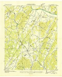
1935 · Birchwood
USGS Topo · 1:24,000