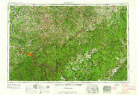
1961 Map of Charleston
USGS Topo · Published 1961About this map
Charleston and its industrial corridor along the Kanawha River serve as the focal point of this 1961 survey, which documents the state capital during a period of mid-century infrastructure growth. The river-driven economy is evident in the cluster of towns including Saint Albans, South Charleston, Dunbar, and Nitro, all linked by an intricate web of rail lines such as the Chesapeake and Ohio RR and New York Central RR.
Find a feature on this map
136 named features on this map. Tap any name to fly to it.
Don’t see what you’re looking for? This feature index may not catch every label — zoom into the map to look around manually.
Map Details
Editions of this 1961 Charleston Map
This is the sole edition of this map. No revisions or reprints were ever made.
Other maps of this area

1886 · St. George
USGS Topo · 1:125,000

1887 · Warfield
USGS Topo · 1:125,000

1887 · Hinton
USGS Topo · 1:125,000

1887 · Lewisburg
USGS Topo · 1:125,000

1889 · Nicholas
USGS Topo · 1:125,000

1889 · Beverly
USGS Topo · 1:125,000

1891 · Lewisburg
USGS Topo · 1:125,000

1891 · Nicholas
USGS Topo · 1:125,000

1891 · Huntersville
USGS Topo · 1:125,000

1891 · Oceana
USGS Topo · 1:125,000