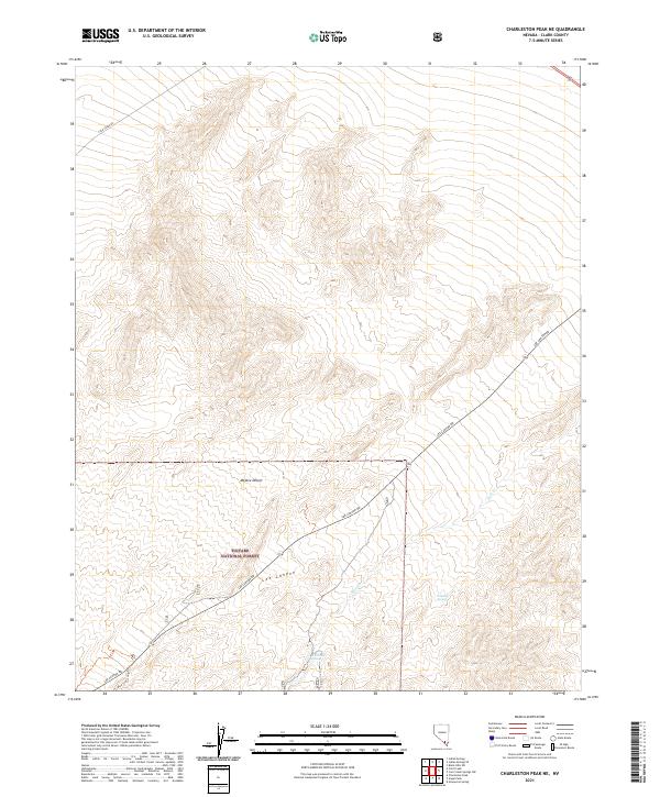
2021 Map of Charleston Peak NE
USGS Topo · Published 2021About this map
Toiyabe National Forest encompasses much of this high-desert landscape in Clark County, where the transition from the Mojave Desert floor into the Spring Mountains is clearly defined. The terrain is marked by seasonal water sources and drainage patterns, including Deer Cr and localized features like Whiskey Spring and Mud Hole Spring. Human activity is primarily centered around recreation and transportation corridors, with Lee Canyon Rd and Cold Creek Rd providing access into the higher elevations. This 2021 survey captures the network of modern trails, such as the Blue Tree Loop Tr, which navigate through the rugged topography of Lee Canyon. The map offers a detailed view of the public land management and the hydrological features essential for life in this arid environment.
Find a feature on this map
13 named features on this map. Tap any name to fly to it.
Don’t see what you’re looking for? This feature index may not catch every label — zoom into the map to look around manually.
Map Details
Editions of this 2021 Charleston Peak NE Map
This is the sole edition of this map. No revisions or reprints were ever made.
Other maps of this area

1907 · Las Vegas
USGS Topo · 1:250,000

1908 · Las Vegas
USGS Topo · 1:250,000

1942 · Indian Spring
USGS Topo · 1:125,000

1945 · Sheep Range
USGS Topo · 1:125,000

1952 · Corn Creek Springs
USGS Topo · 1:62,500

1954 · Las Vegas
USGS Topo · 1:250,000

1957 · Las Vegas
USGS Topo · 1:250,000

1957 · Charleston Peak
USGS Topo · 1:62,500

1959 · Las Vegas
USGS Topo · 1:250,000

1962 · Las Vegas
USGS Topo · 1:250,000