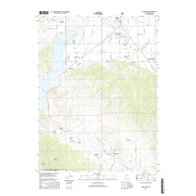
2017 Map of Charleston
USGS Topo · Published 2017About this map
Heber Valley serves as a central hub of irrigation and settlement on this 2017 survey, where the Provo River and an intricate network of man-made waterways like the Lower Charleston Canal and Sagebrush and Spring Cr Canal sustain local agriculture. The map illustrates the close proximity of several townships, including Midway, Charleston, and Heber City, nestled between the waters of the Deer Creek Reservoir and the rising slopes of the Wasatch Range. The terrain transitions from the developed valley floors to the protected wilderness of the Uinta National Forest in the south, where high-elevation landmarks such as Wallsburg Ridge overlook the small community of Wallsburg. For local historians and genealogists, the map provides precise locations for the Charleston Cem and the Wallsburg Cem, alongside family-named geographic features like Hanks Canyon and Billy Haws Canyon.
Find a feature on this map
101 named features on this map. Tap any name to fly to it.
Don’t see what you’re looking for? This feature index may not catch every label — zoom into the map to look around manually.
Map Details
Editions of this 2017 Charleston Map
This is the sole edition of this map. No revisions or reprints were ever made.
Other maps of this area

1885 · Salt Lake
USGS Topo · 1:250,000

1900 · Coalville
USGS Topo · 1:125,000

1903 · Coalville
USGS Topo · 1:125,000

1907 · Strawberry Valley
USGS Topo · 1:125,000

1909 · Strawberry Valley
USGS Topo · 1:125,000

1925 · Ft. Douglas
USGS Topo · 1:125,000

1928 · Ft. Douglas
USGS Topo · 1:125,000

1948 · Orem
USGS Topo · 1:62,500

1948 · Aspen Grove
USGS Topo · 1:24,000

1948 · Bridal Veil Falls
USGS Topo · 1:24,000