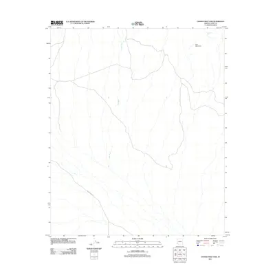
2011 Map of Charlie Died Tank
USGS Topo · Published 2011About this map
Yaqui Wash carves its way through this arid expanse of Yuma County, illustrating the intricate drainage patterns that define the region's desert hydrology. The landscape is dominated by the stark elevations of the Kofa Mountains, which rise in the northeastern portion of the quadrangle. Human presence is sparse, evidenced primarily by the Wellton Kofa Rd cutting across the southwestern corner, providing a vital connection through this remote terrain. A distinctive namesake feature, Charlie Died Tank, sits near the mountain slopes, representing one of the few named water catchment points in an area where such resources are essential for local wildlife and passage. This 2011 survey by the U.S. Geological Survey details the intersection of high desert peaks and the ephemeral washes that shape the geography of the southwestern United States.
Find a feature on this map
4 named features on this map. Tap any name to fly to it.
Don’t see what you’re looking for? This feature index may not catch every label — zoom into the map to look around manually.
Map Details
Editions of this 2011 Charlie Died Tank Map
This is the sole edition of this map. No revisions or reprints were ever made.
Other maps of this area

1942 · Blythe
USGS Topo · 1:250,000

1942 · Vicksburg
USGS Topo · 1:250,000

1954 · Salton Sea
USGS Topo · 1:250,000

1954 · Phoenix
USGS Topo · 1:250,000

1955 · Salton Sea
USGS Topo · 1:250,000

1957 · Phoenix
USGS Topo · 1:250,000

1958 · Phoenix
USGS Topo · 1:250,000

1959 · Salton Sea
USGS Topo · 1:250,000

1960 · Phoenix
USGS Topo · 1:250,000

1962 · Kofa Butte
USGS Topo · 1:62,500