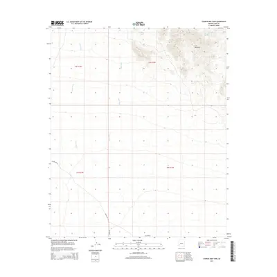
2014 Map of Charlie Died Tank
USGS Topo · Published 2014About this map
Kofa Mountains rise sharply above the desert floor in this arid portion of Yuma County, casting a rugged profile over the surrounding drainage systems. The landscape is defined by its water management history in an environment where moisture is scarce, centered on the oddly named Charlie Died Tank in the northeast. This catchment system, alongside ephemeral watercourses like N Star Wash and Yaqui Wash, illustrates the critical importance of seasonal runoff in the Southwest. To the south, the terrain levels out into the broad expanse of King Valley. Remote access to this wilderness is maintained through the Welton Kofa Rd, a desert route connecting the isolated mountain peaks and valleys to the wider region. The map provides a precise look at the township and range survey lines that divide this otherwise open and undeveloped territory.
Find a feature on this map
11 named features on this map. Tap any name to fly to it.
Don’t see what you’re looking for? This feature index may not catch every label — zoom into the map to look around manually.
Map Details
Editions of this 2014 Charlie Died Tank Map
This is the sole edition of this map. No revisions or reprints were ever made.
Other maps of this area

1942 · Blythe
USGS Topo · 1:250,000
1942 · Vicksburg
USGS Topo · 1:250,000

1954 · Salton Sea
USGS Topo · 1:250,000
1954 · Phoenix
USGS Topo · 1:250,000

1955 · Salton Sea
USGS Topo · 1:250,000
1957 · Phoenix
USGS Topo · 1:250,000
1958 · Phoenix
USGS Topo · 1:250,000
1959 · Salton Sea
USGS Topo · 1:250,000
1960 · Phoenix
USGS Topo · 1:250,000
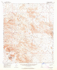
1962 · Kofa Butte
USGS Topo · 1:62,500