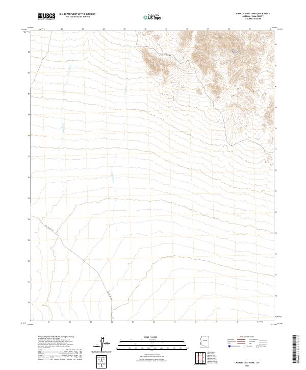
2021 Map of Charlie Died Tank
USGS Topo · Published 2021About this map
Kofa Mountains rise in the northeastern corner of this desert landscape, overlooking a series of broad alluvial drainages and ancient dry watercourses. The terrain is defined by the steady flow of N Star Wash and Yaqui Wash, which carve through the arid plains toward the south. This area is historically marked by the presence of the Wellton-Kofa Rd, a primary route connecting the high peaks to the lower desert floor. The map shows the systematic organization of the Public Land Survey System, including sections within t2s r16w and t3s r17w. This 2021 topographic record captures the enduring remote character of Yuma County, where modern infrastructure remains limited to these essential desert corridors.
Find a feature on this map
9 named features on this map. Tap any name to fly to it.
Don’t see what you’re looking for? This feature index may not catch every label — zoom into the map to look around manually.
Map Details
Editions of this 2021 Charlie Died Tank Map
This is the sole edition of this map. No revisions or reprints were ever made.
Other maps of this area

1942 · Blythe
USGS Topo · 1:250,000

1942 · Vicksburg
USGS Topo · 1:250,000

1954 · Salton Sea
USGS Topo · 1:250,000

1954 · Phoenix
USGS Topo · 1:250,000

1955 · Salton Sea
USGS Topo · 1:250,000

1957 · Phoenix
USGS Topo · 1:250,000

1958 · Phoenix
USGS Topo · 1:250,000

1959 · Salton Sea
USGS Topo · 1:250,000

1960 · Phoenix
USGS Topo · 1:250,000

1962 · Kofa Butte
USGS Topo · 1:62,500