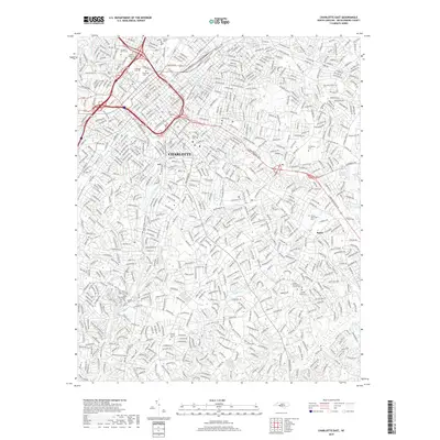
2019 Map of Charlotte East
USGS Topo · Published 2019About this map
Old Settlers Cem and the Elmwood Cem complex serve as central landmarks in this detailed landscape of Charlotte, where the city's modern grid intersects its earliest burial grounds and historical institutional roots. The area is defined by a dense network of transit, from the Seaboard St Line RR corridor to the surrounding Interstate systems, reflecting decades of urban expansion. Significant cultural and educational hubs are visible, including the grounds of Johnson C Smith Univ and numerous religious sites like Sardis Presbyterian Church Cem. South of the city center, the terrain is shaped by the winding courses of McMullen Cr and Little Sugar Cr, where greenways now trace the paths once governed by local drainage and development. Historical layers are particularly evident in sites like the Sardis Slave Cem, providing critical documentation for genealogical research and local history within the suburban fabric of Rama.
Find a feature on this map
31 named features on this map. Tap any name to fly to it.
Don’t see what you’re looking for? This feature index may not catch every label — zoom into the map to look around manually.
Map Details
Editions of this 2019 Charlotte East Map
This is the sole edition of this map. No revisions or reprints were ever made.
Other maps of this area

1905 · Charlotte
USGS Topo · 1:48,000

1907 · Charlotte
USGS Topo · 1:62,500

1941 · Charlotte
USGS Topo · 1:125,000

1942 · Charlotte
USGS Topo · 1:125,000

1948 · Paw Creek
USGS Topo · 1:24,000

1948 · Derita
USGS Topo · 1:24,000

1948 · Charlotte East
USGS Topo · 1:24,000

1948 · Charlotte West
USGS Topo · 1:24,000

1949 · Charlotte West
USGS Topo · 1:24,000

1949 · Charlotte East
USGS Topo · 1:24,000
Featured Places
- Charlotte, NC
- Providence Park, Charlotte
- Castleton Gardens, Charlotte
- Eastfield, Charlotte
- Pellyn Wood, Charlotte