
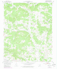
1954 Map of Charlotte
USGS Topo · Published 1955About this map
The White River and its intricate network of tributaries, including Dota Creek and Curia Creek, define this 1954 landscape in Independence County. The settlement pattern is characterized by small rural communities like Charlotte and Walnut Grove, connected by a dense concentration of local family and community sites. Researchers will find numerous burial grounds such as Convenience Cem, McDonald Cem, and Dorr Cem, alongside focal points for local social life like Antioch Ch and Pleasant Hill Ch.
Find a feature on this map
42 named features on this map. Tap any name to fly to it.
Don’t see what you’re looking for? This feature index may not catch every label — zoom into the map to look around manually.
Map Details
Editions of this 1954 Charlotte Map
2 editions found
Other maps of this area

1890 · Batesville
USGS Topo · 1:125,000

1891 · Batesville
USGS Topo · 1:125,000

1932 · Strawberry
USGS Topo · 1:62,500

1935 · Strawberry
USGS Topo · 1:62,500

1935 · Newport
USGS Topo · 1:62,500

1941 · Strawberry
USGS Topo · 1:62,500

1942 · Salado
USGS Topo · 1:31,680

1943 · Cave City
USGS Topo · 1:31,680

1943 · Sulphur Rock
USGS Topo · 1:31,680

1953 · Memphis
USGS Topo · 1:250,000