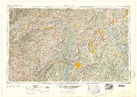
1954 Map of Charlotte
USGS Topo · Published 1954About this map
Charlotte serves as the focal point of this mid-century regional survey, surrounded by a network of industrial and agricultural hubs across the Piedmont. To the west, the landscape rises into the South Mountains and Brush Mountains, while the Catawba River and Yadkin River systems define the drainage of the central plains. This era shows the region's educational and military landscape, featuring Davidson College, Lenoir Rhyne College, and the Charlotte Naval Ammunition Depot.
Find a feature on this map
49 named features on this map. Tap any name to fly to it.
Don’t see what you’re looking for? This feature index may not catch every label — zoom into the map to look around manually.
Map Details
Editions of this 1954 Charlotte Map
2 editions found

Other maps of this area

1889 · Wilkesboro
USGS Topo · 1:125,000

1891 · Roan Mountain
USGS Topo · 1:125,000

1891 · Wilkesboro
USGS Topo · 1:125,000

1891 · Yadkinville
USGS Topo · 1:125,000

1893 · Cranberry
USGS Topo · 1:125,000

1893 · Statesville
USGS Topo · 1:125,000

1893 · Yadkinville
USGS Topo · 1:125,000

1894 · Roan Mountain
USGS Topo · 1:125,000

1895 · Hickory
USGS Topo · 1:125,000

1895 · Cranberry
USGS Topo · 1:125,000