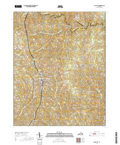
2019 Map of Chase City
USGS Topo · Published 2019About this map
Chase City serves as the central hub of this modern topography, situated along the border of Lunenburg Co and Mecklenburg Co. The landscape is defined by the winding course of the South Meherrin River to the north and a network of named tributaries including Finneywood Cr, Horsepen Cr, and Butcher Cr. Local heritage is preserved in numerous family and community sites such as Bethlehem Cem, Woodlawn Cem, and Friendship Cem. Higher education and infrastructure are represented by the Southside Virginia Community College and the Chase City Municipal Airport. To the north and south, smaller settlements like Finneywood, Thynedale, and Esnon anchor the rural landscape, while historical crossing points like the Tucker Mill Bridge and Rocky Mill Bridge mark the enduring transit routes across the river.
Find a feature on this map
81 named features on this map. Tap any name to fly to it.
Don’t see what you’re looking for? This feature index may not catch every label — zoom into the map to look around manually.
Map Details
Editions of this 2019 Chase City Map
This is the sole edition of this map. No revisions or reprints were ever made.
Other maps of this area

1941 · Clarksville
USGS Topo · 1:48,000

1943 · Clarksville
USGS Topo · 1:62,500

1953 · Greensboro
USGS Topo · 1:250,000

1954 · Greensboro
USGS Topo · 1:250,000

1954 · Clover
USGS Topo · 1:62,500

1955 · Chase City
USGS Topo · 1:62,500

1955 · Boydton
USGS Topo · 1:62,500

1957 · Clarksville
USGS Topo · 1:62,500

1962 · Greensboro
USGS Topo · 1:250,000

1966 · Greensboro
USGS Topo · 1:250,000