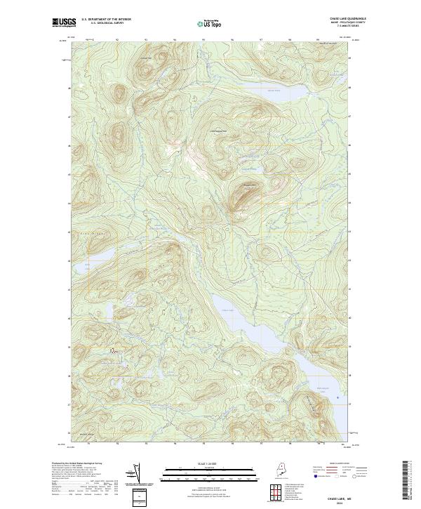
2024 Map of Chase Lake
USGS Topo · Published 2024About this map
Chase Lake and the surrounding woodlands of Piscataquis County appear here in a landscape dominated by interconnected waterways and sharp elevation changes. The hydrology of the region is exceptionally dense, featuring a series of glacial ponds including First Currier Pond, Second Currier Brook, and the larger Munsungan Lake. This network suggests a long history of seasonal timber harvesting and remote sporting access, particularly around Sewall Deadwater Pond and the cascading Thirtyfoot Falls.
Find a feature on this map
42 named features on this map. Tap any name to fly to it.
Don’t see what you’re looking for? This feature index may not catch every label — zoom into the map to look around manually.
Map Details
Editions of this 2024 Chase Lake Map
This is the sole edition of this map. No revisions or reprints were ever made.
Other maps of this area

1931 · Mooseleuk Lake
USGS Topo · 1:48,000

1932 · Musquacook Lakes
USGS Topo · 1:48,000

1935 · Musquacook Lakes
USGS Topo · 1:62,500

1935 · Mooseleuk Lake
USGS Topo · 1:62,500

1954 · Spider Lake
USGS Topo · 1:62,500

1954 · Millinocket Lake
USGS Topo · 1:62,500

1954 · Presque Isle
USGS Topo · 1:250,000

1958 · Presque Isle
USGS Topo · 1:250,000

1960 · Presque Isle
USGS Topo · 1:250,000

1961 · Spider Lake
USGS Topo · 1:62,500