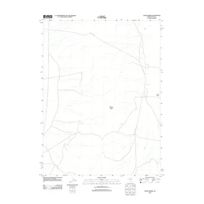
2012 Map of Chase Spring
USGS Topo · Published 2012About this map
Hastings Cutoff traverses the northern reaches of this high-desert landscape, marking the enduring path of a historic mid-19th-century emigrant trail. The terrain is dominated by the prominent spine of Spruce Mountain Ridge, which overlooks a basin where water remains the defining feature for survival and industry. Vital water sources like Chase Spring and Mound Springs provided essential respite in an arid environment, while the presence of the Griswold Shearing Corral on the eastern edge illustrates the area's continued utility for Great Basin ranching. Seasonal drainage patterns are mapped through Latham Crk, showing how geography dictated the movement of both livestock and pioneers across this Elko County corridor.
Find a feature on this map
7 named features on this map. Tap any name to fly to it.
Don’t see what you’re looking for? This feature index may not catch every label — zoom into the map to look around manually.
Map Details
Editions of this 2012 Chase Spring Map
This is the sole edition of this map. No revisions or reprints were ever made.
Other maps of this area

1953 · Spruce Mountain
USGS Topo · 1:62,500

1953 · Spruce Mountain 4
USGS Topo · 1:62,500

1955 · Elko
USGS Topo · 1:250,000

1958 · Elko
USGS Topo · 1:250,000

1962 · Elko
USGS Topo · 1:250,000

1965 · Elko
USGS Topo · 1:250,000

1968 · Independence Valley SW
USGS Topo · 1:24,000

1968 · Snow Water Lake
USGS Topo · 1:24,000

1968 · Ventosa
USGS Topo · 1:24,000
1985 · Wendover
USGS Topo · 1:100,000