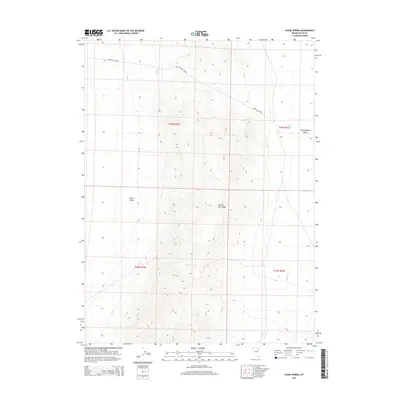
2015 Map of Chase Spring
USGS Topo · Published 2015About this map
Hastings Cutoff snakes across the high basin of this eastern Nevada landscape, following a legacy of emigrant travel that predates modern infrastructure. The high country is dominated by the Spruce Mtn Ridge, which forms a prominent physical barrier between two distinct lowland areas. To the east lies the broad expanse of Independence Valley, while Clover Valley occupies the western portion of the sheet. This terrain is defined by its intermittent water sources, which were historically vital for those traversing the arid corridor. Named hydrological features such as Chase Spring and Mound Springs highlight the critical points where subsurface water reaches the surface, supporting the surrounding rangeland. In the southern reach of the valley, Latham Cr drains toward the flats, illustrating the drainage patterns that have shaped these basins over time.
Find a feature on this map
11 named features on this map. Tap any name to fly to it.
Don’t see what you’re looking for? This feature index may not catch every label — zoom into the map to look around manually.
Map Details
Editions of this 2015 Chase Spring Map
This is the sole edition of this map. No revisions or reprints were ever made.
Other maps of this area

1953 · Spruce Mountain
USGS Topo · 1:62,500

1953 · Spruce Mountain 4
USGS Topo · 1:62,500

1955 · Elko
USGS Topo · 1:250,000

1958 · Elko
USGS Topo · 1:250,000

1962 · Elko
USGS Topo · 1:250,000

1965 · Elko
USGS Topo · 1:250,000

1968 · Independence Valley SW
USGS Topo · 1:24,000

1968 · Snow Water Lake
USGS Topo · 1:24,000

1968 · Ventosa
USGS Topo · 1:24,000
1985 · Wendover
USGS Topo · 1:100,000