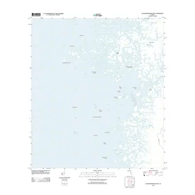
2012 Map of Chassahowitzka Bay
USGS Topo · Published 2012About this map
The Chassahowitzka River flows into a complex network of coastal wetlands and estuaries along the eastern edge of the Gulf of Mexico in this 2012 survey. The landscape is defined by an intricate puzzle of salt marshes and tidal channels, where features like North Blind Creek and South Blind Creek weave through clusters of small landmasses such as Seven Cabbage Island and Slate Island. While largely dominated by water, the map reveals the transition from the river's mouth to the open Chassahowitzka Bay. Inland navigation is suggested by the presence of Seven Cabbage Cut and Haulover Creek, indicating the historical reliance on small boat traffic through these shallow coastal waters. Only a single road, Zebrafinch Ave, touches the southeastern corner, emphasizing the area's isolation from the developed Florida interior.
Find a feature on this map
33 named features on this map. Tap any name to fly to it.
Don’t see what you’re looking for? This feature index may not catch every label — zoom into the map to look around manually.
Map Details
Editions of this 2012 Chassahowitzka Bay Map
This is the sole edition of this map. No revisions or reprints were ever made.
Other maps of this area

1954 · Homosassa
USGS Topo · 1:24,000

1954 · Chassahowitzka Bay
USGS Topo · 1:24,000

1954 · Chassahowitzka
USGS Topo · 1:24,000

1954 · Bayport
USGS Topo · 1:24,000

1954 · Weekiwachee Springs
USGS Topo · 1:24,000

1954 · Ozello
USGS Topo · 1:24,000

1955 · Plant City
USGS Topo · 1:250,000

1958 · Plant City
USGS Topo · 1:250,000

1959 · Plant City
USGS Topo · 1:250,000

1964 · Plant City
USGS Topo · 1:250,000