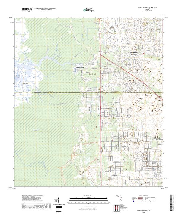
2024 Map of Chassahowitzka
USGS Topo · Published 2024About this map
The Chassahowitzka River and its intricate network of spring-fed tributaries define the western edge of this coastal Florida landscape. This modern survey illustrates the sharp contrast between the protected wetlands of the Chassahowitzka National Wildlife Refuge and the planned residential expansion to the east. Extensive marshlands and tidal creeks like Salt Creek and Crawford Creek dominate the Gulf coast, where the Chassahowitzka Wilderness preserves a labyrinth of sawgrass and mangroves.
Find a feature on this map
73 named features on this map. Tap any name to fly to it.
Don’t see what you’re looking for? This feature index may not catch every label — zoom into the map to look around manually.
Map Details
Editions of this 2024 Chassahowitzka Map
This is the sole edition of this map. No revisions or reprints were ever made.
Other maps of this area

1895 · Tsala Apopka
USGS Topo · 1:62,500

1954 · Lecanto
USGS Topo · 1:24,000

1954 · Homosassa
USGS Topo · 1:24,000

1954 · Chassahowitzka Bay
USGS Topo · 1:24,000

1954 · Brooksville NW
USGS Topo · 1:24,000

1954 · Brooksville
USGS Topo · 1:24,000

1954 · Chassahowitzka
USGS Topo · 1:24,000

1954 · Bayport
USGS Topo · 1:24,000

1954 · Weekiwachee Springs
USGS Topo · 1:24,000

1954 · Ozello
USGS Topo · 1:24,000