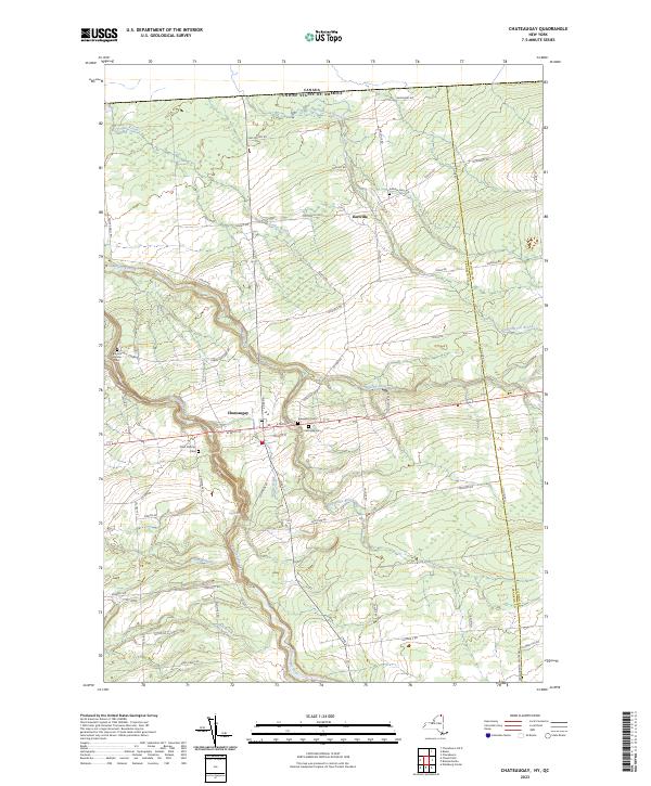
2023 Map of Chateaugay
USGS Topo · Published 2023About this map
Chateaugay and its surroundings near the Canadian border are defined by the deep carving of the Chateaugay River and its dramatic features like High Falls. The landscape transitions from the agricultural flats near the international boundary to the more complex terrain of the Chateaugay Chasm further south. For genealogists, the map is particularly rich in burial sites, documenting several historic grounds including Saint Patricks Cem, Evergreen Cem, and the remote Brayton Hollow Cem. The smaller settlement of Earlville serves as a secondary hub in the northern section of the quadrangle, connected by a network of rural roads such as Earlville Rd and Co Hwy 39. The drainage patterns of the Marble River and Hinchinbrook Brook illustrate the hydrology of Franklin County as it flows toward the border.
Find a feature on this map
64 named features on this map. Tap any name to fly to it.
Don’t see what you’re looking for? This feature index may not catch every label — zoom into the map to look around manually.
Map Details
Editions of this 2023 Chateaugay Map
This is the sole edition of this map. No revisions or reprints were ever made.
Other maps of this area

1915 · Churubusco
USGS Topo · 1:62,500

1915 · Chateaugay
USGS Topo · 1:62,500

1943 · Churubusco
USGS Topo · 1:62,500

1943 · Chateaugay
USGS Topo · 1:62,500

1948 · Ogdensburg
USGS Topo · 1:250,000

1950 · Lake Champlain
USGS Topo · 1:250,000

1951 · Ogdensburg
USGS Topo · 1:250,000

1953 · Ogdensburg
USGS Topo · 1:250,000

1958 · Lake Champlain
USGS Topo · 1:250,000

1961 · Ogdensburg
USGS Topo · 1:250,000