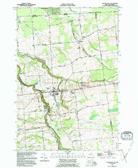
1993 Map of Chateaugay
USGS Topo · Published 1995About this map
Chateaugay serves as the focal point of this northern New York borderland, situated where the Chateaugay River carves the dramatic Chateaugay Chasm. The settlement pattern reflects a long-established agricultural and small-town economy, with various family-named roads like Shea Road, MC Cormick Road, and Hogan Road connecting outlying farms. A distinct international character is evident along the northern margin, where the Port of Entry US Customs marks the crossing into Quebec, and Parc d'Avignon sits just across the Canada-United States border.
Find a feature on this map
50 named features on this map. Tap any name to fly to it.
Don’t see what you’re looking for? This feature index may not catch every label — zoom into the map to look around manually.
Map Details
Editions of this 1993 Chateaugay Map
This is the sole edition of this map. No revisions or reprints were ever made.
Other maps of this area

1915 · Churubusco
USGS Topo · 1:62,500

1915 · Chateaugay
USGS Topo · 1:62,500

1943 · Churubusco
USGS Topo · 1:62,500

1943 · Chateaugay
USGS Topo · 1:62,500

1948 · Ogdensburg
USGS Topo · 1:250,000

1950 · Lake Champlain
USGS Topo · 1:250,000

1951 · Ogdensburg
USGS Topo · 1:250,000

1953 · Ogdensburg
USGS Topo · 1:250,000

1958 · Lake Champlain
USGS Topo · 1:250,000

1961 · Ogdensburg
USGS Topo · 1:250,000