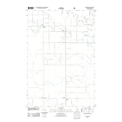
2011 Map of Chatham
USGS Topo · Published 2011About this map
Chatham and the surrounding rural communities of Eben Junction, Traunik, and Limestone characterize this portion of Alger County. The landscape is defined by the headwaters and tributaries of several drainage systems, including Slapneck Creek and the long course of Johnson Creek. This 2011 survey captures the infrastructure of these small settlements, from the Eben Junction Post Office to the Chatham Hill Ski Area. The township's history is rooted in the section lines and rural roads that connect these dispersed clusters, such as the intersection at Chatham Corners. Notable local landmarks like the Limestone Township Cemetery and the Chatham Landing Strip provide specific points of interest for genealogists and local historians tracking the development of this Upper Peninsula region. The map also details small water bodies like Laakso Lake and Ivars Pond, illustrating the hydrology that has shaped the local economy and settlement patterns.
Find a feature on this map
65 named features on this map. Tap any name to fly to it.
Don’t see what you’re looking for? This feature index may not catch every label — zoom into the map to look around manually.
Map Details
Editions of this 2011 Chatham Map
This is the sole edition of this map. No revisions or reprints were ever made.
Other maps of this area

1932 · Rock NE
USGS Topo · 1:31,680

1932 · Skandia SE
USGS Topo · 1:31,680

1932 · Skandia NE
USGS Topo · 1:31,680

1958 · Trenary
USGS Topo · 1:62,500

1958 · Au Train
USGS Topo · 1:62,500

1958 · Skandia
USGS Topo · 1:62,500
1958 · Rock
USGS Topo · 1:62,500

1958 · Marquette
USGS Topo · 1:250,000

1960 · Marquette
USGS Topo · 1:250,000

1961 · Marquette
USGS Topo · 1:250,000