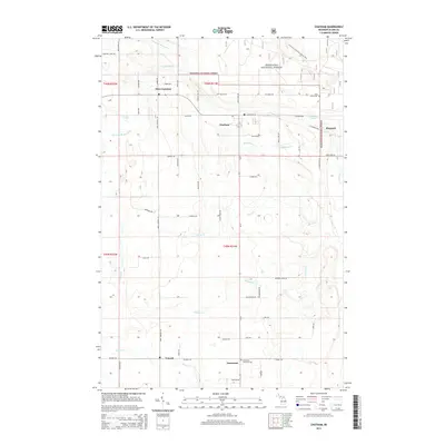
2014 Map of Chatham
USGS Topo · Published 2014About this map
Hiawatha National Forest blankets this portion of the Upper Peninsula, where the landscape is defined by the intricate headwaters of the Slapneck Cr and its various branches. The settlement pattern here reflects a legacy of Finnish and Scandinavian migration, evidenced by local road names such as Takkinen Rd, Haapala Rd, and Koski Rd. These family names rooted in the local geography provide a direct link to the homesteading history of Alger County.
Find a feature on this map
62 named features on this map. Tap any name to fly to it.
Don’t see what you’re looking for? This feature index may not catch every label — zoom into the map to look around manually.
Map Details
Editions of this 2014 Chatham Map
This is the sole edition of this map. No revisions or reprints were ever made.
Other maps of this area

1932 · Rock NE
USGS Topo · 1:31,680

1932 · Skandia SE
USGS Topo · 1:31,680

1932 · Skandia NE
USGS Topo · 1:31,680

1958 · Trenary
USGS Topo · 1:62,500

1958 · Au Train
USGS Topo · 1:62,500

1958 · Skandia
USGS Topo · 1:62,500
1958 · Rock
USGS Topo · 1:62,500

1958 · Marquette
USGS Topo · 1:250,000

1960 · Marquette
USGS Topo · 1:250,000

1961 · Marquette
USGS Topo · 1:250,000