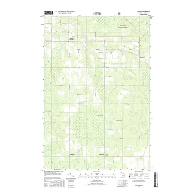
2017 Map of Chatham
USGS Topo · Published 2017About this map
Chatham and the surrounding township of Limestone are defined by a network of rural roads and timbered lands within the Hiawatha National Forest. Small settlements such as Eben Junction, Traunik, and Slapneck are connected by routes like Munising Ave and M 94, reflecting a landscape built on forestry and dispersed agriculture. The map illustrates a complex drainage system featuring Slapneck Cr, Johnson Cr, and Bohemian Cr, which cut through the level to gently undulating terrain of the Upper Peninsula.
Find a feature on this map
51 named features on this map. Tap any name to fly to it.
Don’t see what you’re looking for? This feature index may not catch every label — zoom into the map to look around manually.
Map Details
Editions of this 2017 Chatham Map
This is the sole edition of this map. No revisions or reprints were ever made.
Other maps of this area

1932 · Rock NE
USGS Topo · 1:31,680

1932 · Skandia SE
USGS Topo · 1:31,680

1932 · Skandia NE
USGS Topo · 1:31,680

1958 · Trenary
USGS Topo · 1:62,500

1958 · Au Train
USGS Topo · 1:62,500

1958 · Skandia
USGS Topo · 1:62,500
1958 · Rock
USGS Topo · 1:62,500

1958 · Marquette
USGS Topo · 1:250,000

1960 · Marquette
USGS Topo · 1:250,000

1961 · Marquette
USGS Topo · 1:250,000