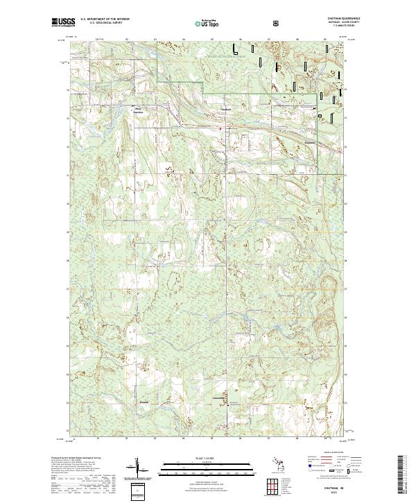
2023 Map of Chatham
USGS Topo · Published 2023About this map
Eben Junction and Chatham anchor the upper portion of this survey, where the northern Michigan landscape is defined by the headwaters of Slapneck Creek and its various branches. The settlement patterns reflect the agrarian and timber heritage of Alger County, with family-named roads like Nykanen Rd, Luoma Rd, and Finn's Spur Rd branching off from M 94. To the south, the terrain transitions into the Hiawatha National Forest, encompassing the smaller communities of Limestone and Traunik. Genealogists will find particular value in the location of the Limestone Township Cem and Pine Grove Cem, as well as the intricate network of local drainage such as Bohemian Creek and Johnson Creek that shaped the early layout of these rural townships.
Find a feature on this map
75 named features on this map. Tap any name to fly to it.
Don’t see what you’re looking for? This feature index may not catch every label — zoom into the map to look around manually.
Map Details
Editions of this 2023 Chatham Map
This is the sole edition of this map. No revisions or reprints were ever made.
Other maps of this area

1932 · Rock NE
USGS Topo · 1:31,680

1932 · Skandia SE
USGS Topo · 1:31,680

1932 · Skandia NE
USGS Topo · 1:31,680

1958 · Trenary
USGS Topo · 1:62,500

1958 · Au Train
USGS Topo · 1:62,500

1958 · Skandia
USGS Topo · 1:62,500
1958 · Rock
USGS Topo · 1:62,500

1958 · Marquette
USGS Topo · 1:250,000

1960 · Marquette
USGS Topo · 1:250,000

1961 · Marquette
USGS Topo · 1:250,000