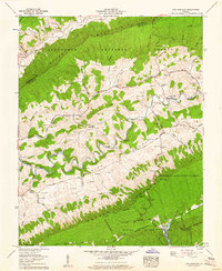
1958 Map of Chatham Hill
USGS Topo · Published 1960About this map
The North Fork Holston River snakes through the deep corridor of Rich Valley, carving a complex path between the massive ridges of Brushy Mountain and Walker Mountain. This mid-century Tennessee Valley Authority survey captures a landscape defined by isolated rural settlements and numerous family cemeteries, such as the Buchanan Cem and Hubble Cem, tucked into the hollows of the Jefferson National Forest. The road network of the era is anchored by the Blue Grass Trail and the Buchanan Highway, connecting small communities like Chatham Hill and Tannersville. To the south, the terrain rises toward Mollys Knob and the developed recreational grounds of Hungry Mother State Park, where Hungry Mother Lake sits at the base of Little Brushy Mtn. The map reveals a high density of small mountain chapels and landmarks like Big Cave, reflecting the localized social geography of these Appalachian ridges.
Find a feature on this map
64 named features on this map. Tap any name to fly to it.
Don’t see what you’re looking for? This feature index may not catch every label — zoom into the map to look around manually.
Map Details
Editions of this 1958 Chatham Hill Map
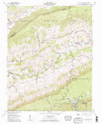
2 editions found
Other maps of this area

1887 · Pocahontas
USGS Topo · 1:125,000

1889 · Wytheville
USGS Topo · 1:125,000

1891 · Tazewell
USGS Topo · 1:125,000

1891 · Pocahontas
USGS Topo · 1:125,000

1891 · Abingdon
USGS Topo · 1:125,000

1892 · Wytheville
USGS Topo · 1:125,000

1894 · Pocahontas
USGS Topo · 1:125,000

1894 · Abingdon
USGS Topo · 1:125,000

1895 · Tazewell
USGS Topo · 1:125,000

1895 · Pocahontas
USGS Topo · 1:125,000