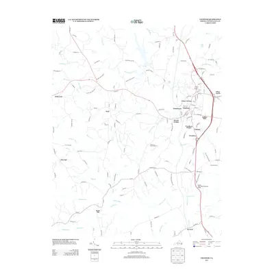
2013 Map of Chatham
USGS Topo · Published 2013About this map
Chatham serves as the focal point of this Virginia landscape, surrounded by a dense network of residential developments including Gilmer Terrace, Woodlawn Heights, and Halifax Hills. The terrain is defined by the winding course of the Banister River and its numerous tributaries, such as Cherrystone Cr and Bearskin Cr. This 2013 survey illustrates the modern residential expansion around the historic core, while the presence of the State Prison Camp Number 15 and various named mills like Jones Mill point to the diverse land use in Pittsylvania County. Small rural settlements like Weal and Flint Hill persist along the winding secondary roads that branch away from the main corridors of Route 57 and Route 29. Significant water bodies such as Falls Lake and Selfs Lake are prominent landmarks in the northern half of the quadrangle.
Find a feature on this map
132 named features on this map. Tap any name to fly to it.
Don’t see what you’re looking for? This feature index may not catch every label — zoom into the map to look around manually.
Map Details
Editions of this 2013 Chatham Map
This is the sole edition of this map. No revisions or reprints were ever made.
Other maps of this area

1921 · Chatham
USGS Topo · 1:48,000

1922 · Callands
USGS Topo · 1:48,000

1923 · Danville
USGS Topo · 1:48,000

1923 · Chatham
USGS Topo · 1:62,500

1924 · Draper
USGS Topo · 1:48,000

1924 · Callands
USGS Topo · 1:62,500

1925 · Danville
USGS Topo · 1:62,500

1926 · Draper
USGS Topo · 1:62,500

1944 · Draper
USGS Topo · 1:62,500

1944 · Callands
USGS Topo · 1:62,500