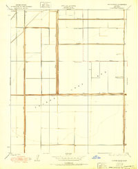
1950 Map of Chatom Ranch
USGS Topo · Published 1950About this map
The dry expanse of the Tulare Lake Bed dominates this landscape in Kings County, illustrating a period of intensive agricultural reclamation in the Central Valley. The map documents the engineering required to manage this former lake territory, featuring an extensive system of embankments such as Cohn Levee, Lovelace Levee, and Goldberg Levee. These structures, alongside the Wilbur Ditch, channel the waters of the Kings River and Tule River across the basin floor.
Find a feature on this map
13 named features on this map. Tap any name to fly to it.
Don’t see what you’re looking for? This feature index may not catch every label — zoom into the map to look around manually.
Map Details
Editions of this 1950 Chatom Ranch Map
This is the sole edition of this map. No revisions or reprints were ever made.
Other maps of this area

1914 · Lost Hills
USGS Topo · 1:125,000

1929 · Guernsey
USGS Topo · 1:31,680

1929 · Stratford
USGS Topo · 1:31,680

1929 · Westhaven
USGS Topo · 1:31,680

1930 · Middle Dome
USGS Topo · 1:31,680

1931 · Harvester
USGS Topo · 1:31,680

1932 · El Rico Ranch
USGS Topo · 1:31,680

1932 · Dudley Ridge
USGS Topo · 1:31,680

1933 · Kettleman City
USGS Topo · 1:31,680

1933 · Chatom Ranch
USGS Topo · 1:31,680