
1929 Map of Guernsey
USGS Topo · Published 1929About this map
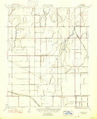
Agricultural development in the Central Valley is defined by an intricate network of irrigation infrastructure in this late 1920s survey. The landscape is dominated by a grid of canals and ditches designed to manage water flow across the flat terrain, including the Last Chance Ditch, New Deal Canal, and Chamberlain Ditch. These man-made waterways interact with natural drainage patterns like Mussel Slough and Lone Oak Slough, reflecting the massive engineering efforts required to sustain farming in Kings County.
Find a feature on this map
33 named features on this map. Tap any name to fly to it.
Don’t see what you’re looking for? This feature index may not catch every label — zoom into the map to look around manually.
Map Details
Editions of this 1929 Guernsey Map
2 editions found
Other maps of this area

1926 · Hanford
USGS Topo · 1:31,680

1927 · Remnoy
USGS Topo · 1:31,680

1927 · Lemoore
USGS Topo · 1:31,680

1928 · Waukena
USGS Topo · 1:31,680

1928 · Corcoran
USGS Topo · 1:31,680

1929 · Stratford
USGS Topo · 1:31,680

1932 · El Rico Ranch
USGS Topo · 1:31,680

1933 · Chatom Ranch
USGS Topo · 1:31,680
1935 · Chatom Ranch
USGS Topo · 1:31,680
1936 · El Rico Ranch
USGS Topo · 1:31,680