
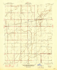
1927 Map of Remnoy
USGS Topo · Published 1927About this map
Agricultural development in the San Joaquin Valley defines this landscape, where an intricate network of irrigation channels like the East Branch Peoples Ditch, Settlers Ditch, and Lakeland Canal cuts across the terrain to manage water from natural features like Cross Creek. The tiny settlement of Remnoy serves as a central point along the Southern Pacific railroad line, illustrating the importance of rail transport for rural Central California in the mid-1920s.
Find a feature on this map
20 named features on this map. Tap any name to fly to it.
Don’t see what you’re looking for? This feature index may not catch every label — zoom into the map to look around manually.
Map Details
Editions of this 1927 Remnoy Map
2 editions found
Other maps of this area

1926 · Goshen
USGS Topo · 1:31,680

1926 · Hanford
USGS Topo · 1:31,680

1926 · Burris Park
USGS Topo · 1:31,680

1927 · Traver
USGS Topo · 1:31,680

1927 · Laton
USGS Topo · 1:31,680

1927 · Paige
USGS Topo · 1:31,680

1928 · Waukena
USGS Topo · 1:31,680

1929 · Guernsey
USGS Topo · 1:31,680
1942 · Corcoran
USGS Topo · 1:62,500
1942 · Tulare
USGS Topo · 1:62,500