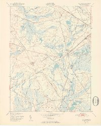
1951 Map of Chatsworth
USGS Topo · Published 1951About this map
Apple Pie Hill rises above a landscape dominated by the cedar swamps and cranberry culture of the New Jersey Pine Barrens at the midpoint of the twentieth century. The area is defined by the heavy presence of Lebanon State Forest and the Central Railroad of New Jersey, which cuts diagonally across the terrain through Chatsworth. Numerous family-named nodes such as Butler Place, Johnson Place, and Reeds Place dot the woodland, indicating the early settlement patterns of these interior barrens. The industrial character of the era is evident in the sprawling Cranberry Bogs and the specialized Zinc Ore Refinery near the Jersey Central Road. Water systems like the West Branch Wading River and Shoal Branch weave through the lowlands, supporting the local agricultural economy and connecting the various outposts of Speedwell, Paisley, and Friendship.
Find a feature on this map
43 named features on this map. Tap any name to fly to it.
Don’t see what you’re looking for? This feature index may not catch every label — zoom into the map to look around manually.
Map Details
Editions of this 1951 Chatsworth Map
2 editions found
Other maps of this area

1884 · Whitings
USGS Topo · 1:62,500

1888 · Pemberton
USGS Topo · 1:62,500

1888 · Little Egg Harbor
USGS Topo · 1:62,500

1888 · Whitings
USGS Topo · 1:62,500

1890 · Mullica
USGS Topo · 1:62,500

1893 · Little Egg Harbor
USGS Topo · 1:62,500

1894 · Pemberton
USGS Topo · 1:62,500

1894 · Mullica
USGS Topo · 1:62,500

1898 · Pemberton
USGS Topo · 1:62,500

1898 · Mullica
USGS Topo · 1:62,500