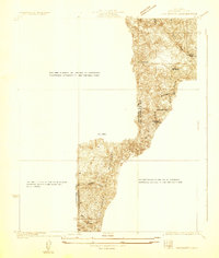
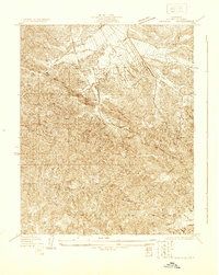
1929 Map of Chatsworth
USGS Topo · Published 1929About this map
Oakwood Cemetery and the distinct rock formations of Garden of the Gods anchor this topographical study of the rugged borderlands between Ventura and Los Angeles Counties. Surveyed in 1929, the map reveals a transition from the developing Twin Lakes Addition to the undeveloped stretches of Simi. The landscape is defined by its deep drainages, including Dayton Canyon and Bell Canyon, which reveal the complex terrain that governed early 20th-century expansion. The steel of the Southern Pacific railroad line cuts across the northern landscape, illustrating the vital infrastructure connecting this foothill region to the larger southern California network. While the southern portions of the map show the expanding City of Los Angeles boundary, the presence of isolated water sources like H-a-Leah Sprs and Devil Creek highlights the essential role of natural hydrology in shaping the settlement patterns of this arid environment.
Find a feature on this map
11 named features on this map. Tap any name to fly to it.
Don’t see what you’re looking for? This feature index may not catch every label — zoom into the map to look around manually.
Map Details
Editions of this 1929 Chatsworth Map
This is the sole edition of this map. No revisions or reprints were ever made.
Other maps of this area

1903 · Calabasas
USGS Topo · 1:62,500

1903 · Camulos
USGS Topo · 1:125,000

1903 · Santa Susana
USGS Topo · 1:62,500

1925 · Chatsworth
USGS Topo · 1:24,000

1927 · Chatsworth
USGS Topo · 1:24,000
1928 · Zelzah
USGS Topo · 1:24,000

1928 · Dry Canyon
USGS Topo · 1:24,000
1928 · Reseda
USGS Topo · 1:24,000
1929 · Zelzah
USGS Topo · 1:24,000
1929 · Newhall
USGS Topo · 1:24,000